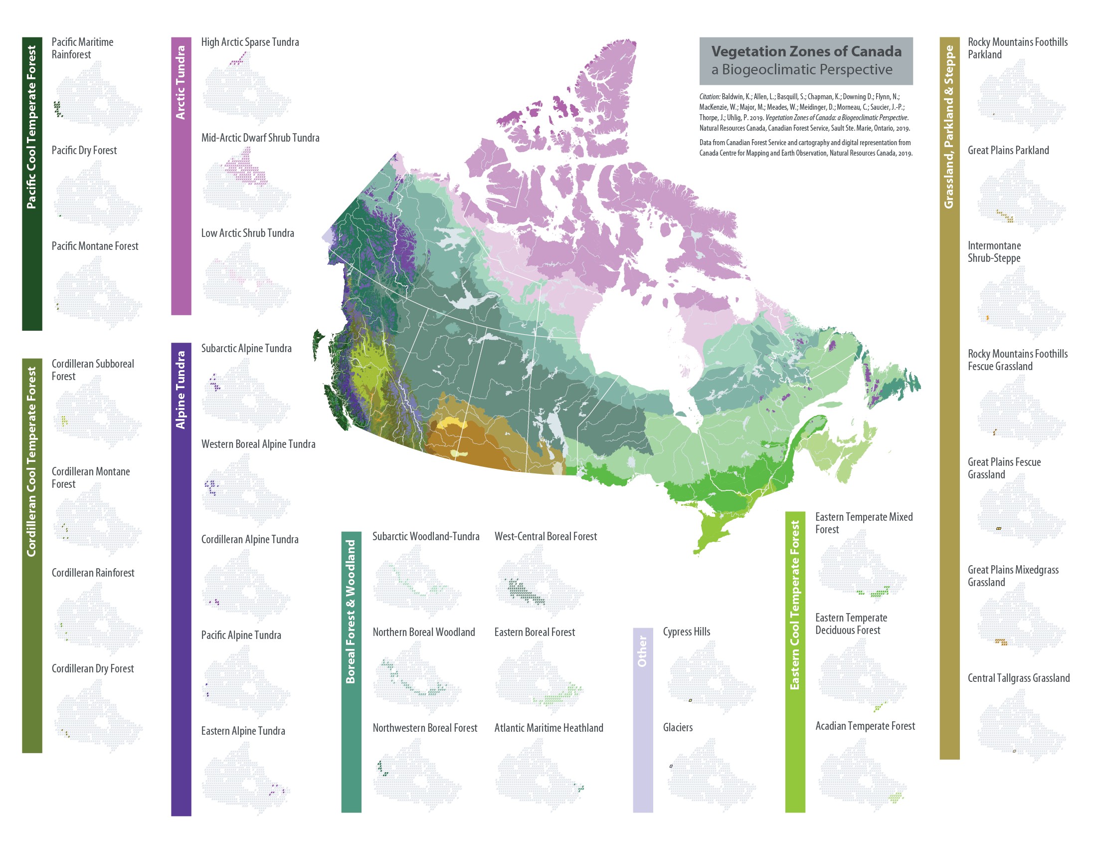
Vegetation Zones of Canada
Vegetation zones are broad geographic areas that are characterized by distinctive ecological responses to climate, as expressed by vegetation, soils and water. Within a vegetation zone, the ecologically effective climate will result in the development of similar trends in vegetation succession on similar substrates occurring on similar parent materials at similar positions on the landscape. To facilitate mapping at the national scale in the absence of full information about all ecosystems on all landforms, soils and successional vegetation stages, the concept of “normal” or "zonal" site is used for comparing regions. Conceptually, “normal” sites have deep loamy soils, with neither a lack nor an excess of soil nutrients or moisture, and are located in well-drained positions on the landscape which are neither protected from nor exposed to local microclimatic extremes. Thus, in principle, when the vegetation development of “normal” sites in widely separated areas is compared, the local effects of soil or topographic differences are eliminated. Consequently, any differences in the vegetation chronosequence should be due to the ecologically effective regional climate.
Although “Vegetation Zones of Canada” is underlain by a true ecological classification (i.e., the CNVC), it is a map product, not a classification. In other words, it is a secondary spatial interpretation of the CNVC, not the classification itself. Compared to previous treatments of Canadian vegetation zonation (e.g., Halliday/Rowe "Forest Regions of Canada"), the level II Vegetation Zones presented here benefit from more recent provincial/territorial knowledge, better ground-plot data, and new climate modeling technology to better represent elevational climatic gradients (esp. in western Canada), climate-driven floristic zonation in the Prairie grasslands, and the bounds of Acadian vegetation in Atlantic Canada.
For a full report on the Vegetation Zones of Canada, please see the documents here (en français).
Click on the individual links below to download the map and associated metadata files: